Maps

Visualize Your Road Ratings Data in GIS

Visualize Your Road Ratings Data in GIS

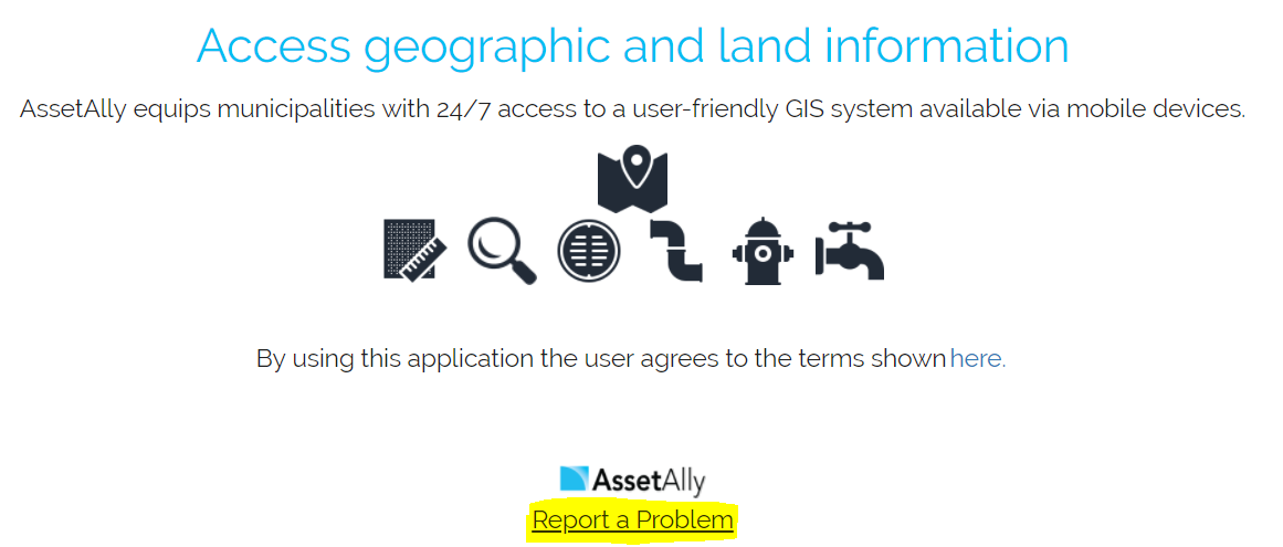
Every odd year, Wisconsin municipalities are required to conduct road ratings and submit their findings to the Wisconsin Department of Transportation (WisDOT). Learn how AssetAlly can help your team visualize your ratings and the evolving state of your community’s roads, making it easier to prioritize road maintenance and adjust your budget accordingly.


California - Fires and Flooding

California - Fires and Flooding

At least 13 lives have been lost in a tragic mudflow that swept across Ventura and Santa Barbara Counties in California earlier this week. Heavy rains have made Southern California susceptible to flooding and debris flows, particularly following the recent wildfires which stripped the steep terrain of vegetation. Vegetation is a crucial component involved in holding the land together during periods of precipitation. The fires transformed the physical properties of the soil, making it less absorbent. Thus, the soil becomes much more vulnerable to erosion.

Mapping the Winter Solstice

Mapping the Winter Solstice

Well, it is officially winter! The time and date of the solstice change ever so slightly by year, but this year’s solstice occurs at 11:28 a.m. Eastern Time. The winter solstice marks the shortest period of daylight in the Northern Hemisphere. However, today is not the day of the latest sunrise or earliest sunset. Rather, most areas within mid-latitudes witness the earliest sunset two weeks prior to the solstice, while the latest sunrise does not occur until the beginning of January!

As-built Upload Tool

As-built Upload Tool

Uploading your record drawings as points using your Document Upload Tool is all well and good, but what if you want your asbuilts tied directly to your assets? Look no farther than the Asbuilt Upload Tool. If you have the tool in your site, you will see it under one of your tabs with this icon:

Table View vs. List View

Table View vs. List View

When identifying features, you have the ability to view your data in a tabular Excel-like format without leaving your map. In this article we'll identify some sanitary structures and then demonstrate how to switch between the List and Table views available for displaying results. We'll first turn on the targeted layer--in this case, our sanitary layer--and use the rectangular identify tool to select a group of sanitary features to observe in our results window.

GIS & GISCorps

GIS & GISCorps

GISCorps is a group of GIS professionals that volunteer their time and skills in order to create a better world. Started in 2003, GISCorps' goals revolve around helping to improve quality of life through supporting humanitarian relief, enhancing environmental analysis, encouraging and fostering economic development, supporting community planning and development, strengthening local capacity by adopting and using information technology, and supporting health and education related activities.

GIS & Local Insights

GIS & Local Insights

Utilizing GIS for its mapping capabilities is a no-brainer. Answering questions like "what's the fastest route to work" or "where is that manhole located" are all great uses of GIS. But, using GIS for local insights can help individuals, businesses, communities, virtually anyone to make better, smarter choices.

Markup Tools

Markup Tools

Many of us find the need to mark our maps, draw in areas, and annotate decisions. We all have a preferred method depending on our needs. Tim prefers map printouts annotated with red pen. I mark up maps more digitally by using sharpie on my computer monitor (not really, IT would hate me). Below we'll show you how to mark up your GIS map (without resorting to ink-based marking devices). Within the Markup tab, you'll see your drawing options by clicking the triangle next to the drawing button.

GIS & Ocean Ecosystems

GIS & Ocean Ecosystems

With this new 3D map, oceanographers, scientists, conservationists, and more can track ecosystems in unprecedented detail. This tool, which can divide the water masses of oceans into precise, detailed categories can help conservation efforts, as it maps data that shows why marine animals live where they do. This can help track which parts of the ocean will be most habitable for marine life - and thus more necessary to protect.

GIS & WI MS4 Audits

20170118_100651
20170118_100651

Yesterday, our Waukesha office held a seminar concerning Wisconsin DNR audits for MS4 permit holders. While a bunch of great information was discussed, our very own Bronson Jastrow, GIS whiz and famed #TipTuesday writer, presented on how GIS can help keep communities prepared- especially if they're facing a dreaded audit!

One of the best ways GIS can help is by keeping communities organized. Our GIS capabilities allow you to link documents (such as design and compliance records) straight into a map, making them easy to access and all compiled in the same place.

2
2

Beyond the simplicity of linking, viewing, and organizing documents, we have a suite of tools that can make preparing for a DNR audit a breeze, such as: Erosion Control & Inspection, Illicit Discharge, Pond Inspection, and Storm Structure Maintenance & Cleaning - keeping a history of compliance on each storm water asset.

2
2

If you want more information on WDNR MS4 audits and how GIS can help, check in with your favorite GIS tech, or hop over to our website where we have the presentation slides uploaded!