The Wisconsin DNR Urban Nonpoint Source & Storm Water Management (UNPS) Planning Grant Program applications are due April 17, 2023. Here are a few suggestions on how to prepare for these projects in your GIS!

Articles
Explore AssetAlly Tips & Tools.
See GIS in Action.
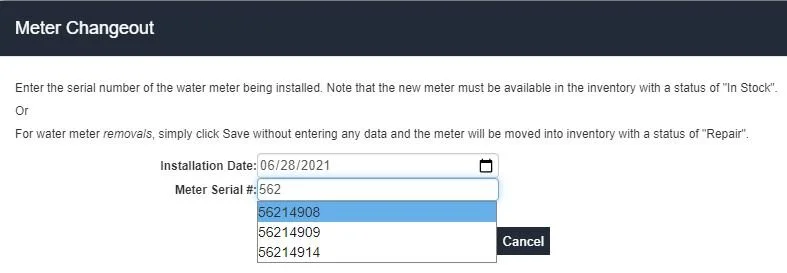
AssetAlly Version 11.1 will be released next week, and it is chock-full of exciting UX enhancements, bug fixes, and new ways for your municipality to manage your assets using the latest layers, tools, and dashboards. Learn what you need to know to take advantage of the latest and greatest version of AssetAlly.
Why does it always feel like the end of construction season arrives when there’s still too much to do and not enough time to get everything done? While we can’t days to your calendar, our GIS Maintenance Cheat Sheet can help you stay organized and avoid administrative headaches as you navigate this busy time of year.
As we wrap up all things 2020, the AssetAlly team is hard at work developing new ways to bring you valuable GIS content in 2021. While we plan for what’s next, we like to look back at the content you liked most over the last year. So without further ado, here are the top 5 AssetAlly articles of 2020.
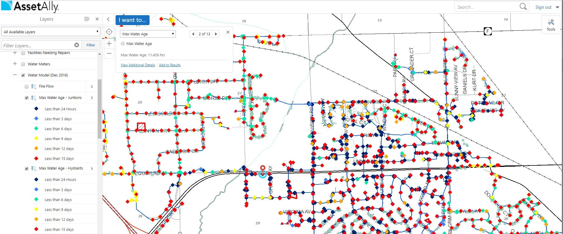
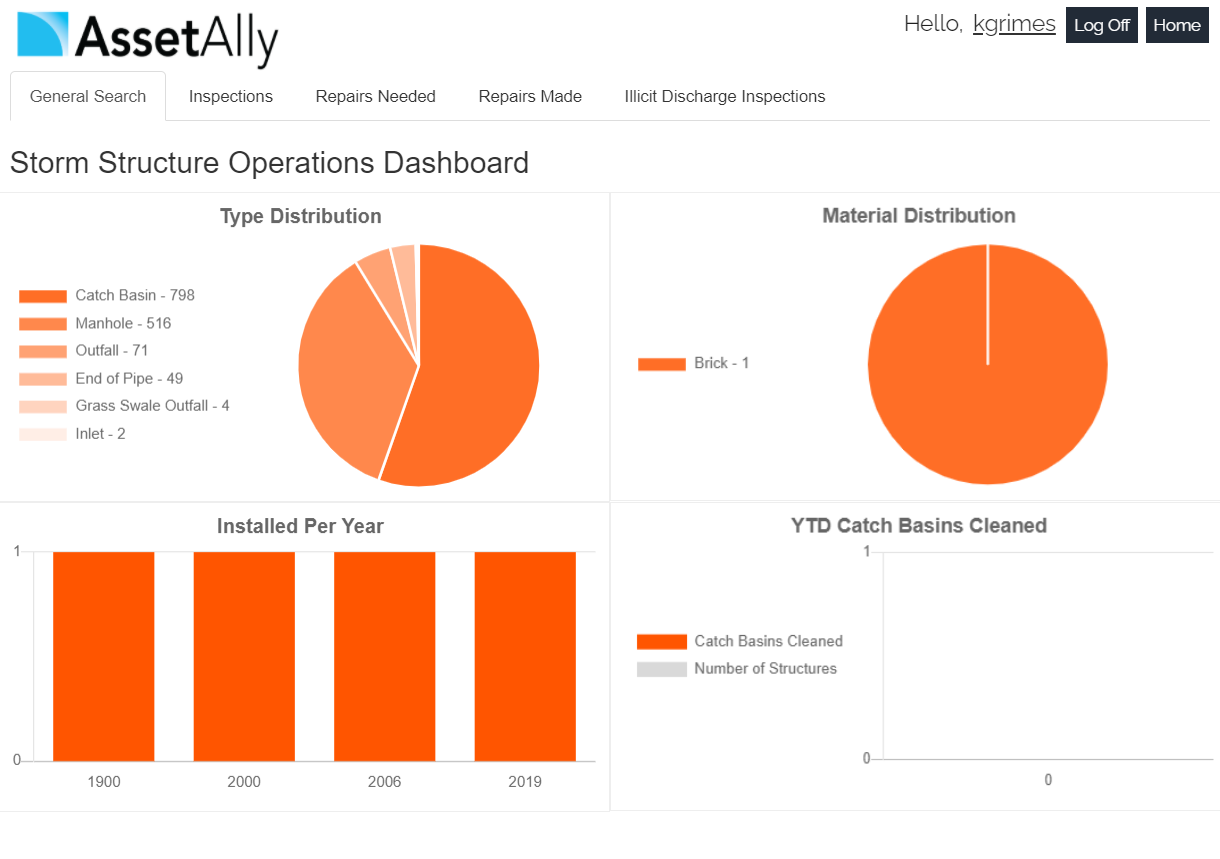
AssetAlly now includes new Operations Dashboards that give you an instant graphic overview of important community data like your team’s current workload, annual routine maintenance progress, and other essential infrastructure statistics. Learn how this new feature will help you spend less time crunching numbers and more time improving your community.
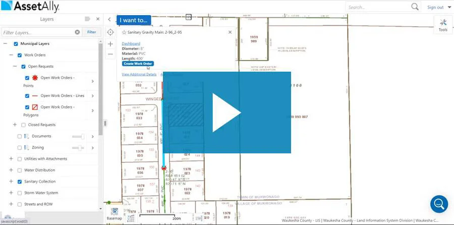
AssetAlly Work Orders recently underwent a significant makeover. This update included a more intuitive dashboard, better process for assigning tasks, and a more seamless Work Order closing process. Learn how the Village of Howard has taken full advantage of these improvements to stay on top of their municipal customer requests and more effectively manage their team.