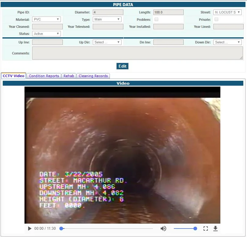
TipTuesday

Sign Support Tool

Sign Support Tool

Nothing says spring cleaning like completing an inventory on the conditions of your street signs. Let us help you spruce up your town by starting or continuing to build on your inventory with our Street Sign Support tool! Our street sign tool is quick and easy to use. The tool provides a preloaded dashboard that gives users the ability to input information on new or existing signage with just a few short clicks.

As-built Upload Tool

As-built Upload Tool

Uploading your record drawings as points using your Document Upload Tool is all well and good, but what if you want your asbuilts tied directly to your assets? Look no farther than the Asbuilt Upload Tool. If you have the tool in your site, you will see it under one of your tabs with this icon:

Table View vs. List View

Table View vs. List View

When identifying features, you have the ability to view your data in a tabular Excel-like format without leaving your map. In this article we'll identify some sanitary structures and then demonstrate how to switch between the List and Table views available for displaying results. We'll first turn on the targeted layer--in this case, our sanitary layer--and use the rectangular identify tool to select a group of sanitary features to observe in our results window.

Markup Tools

Markup Tools

Many of us find the need to mark our maps, draw in areas, and annotate decisions. We all have a preferred method depending on our needs. Tim prefers map printouts annotated with red pen. I mark up maps more digitally by using sharpie on my computer monitor (not really, IT would hate me). Below we'll show you how to mark up your GIS map (without resorting to ink-based marking devices). Within the Markup tab, you'll see your drawing options by clicking the triangle next to the drawing button.