

If there are two things we folks at R/M love, they are sustainability and GIS. A new GIS ocean map combines our passion for both!
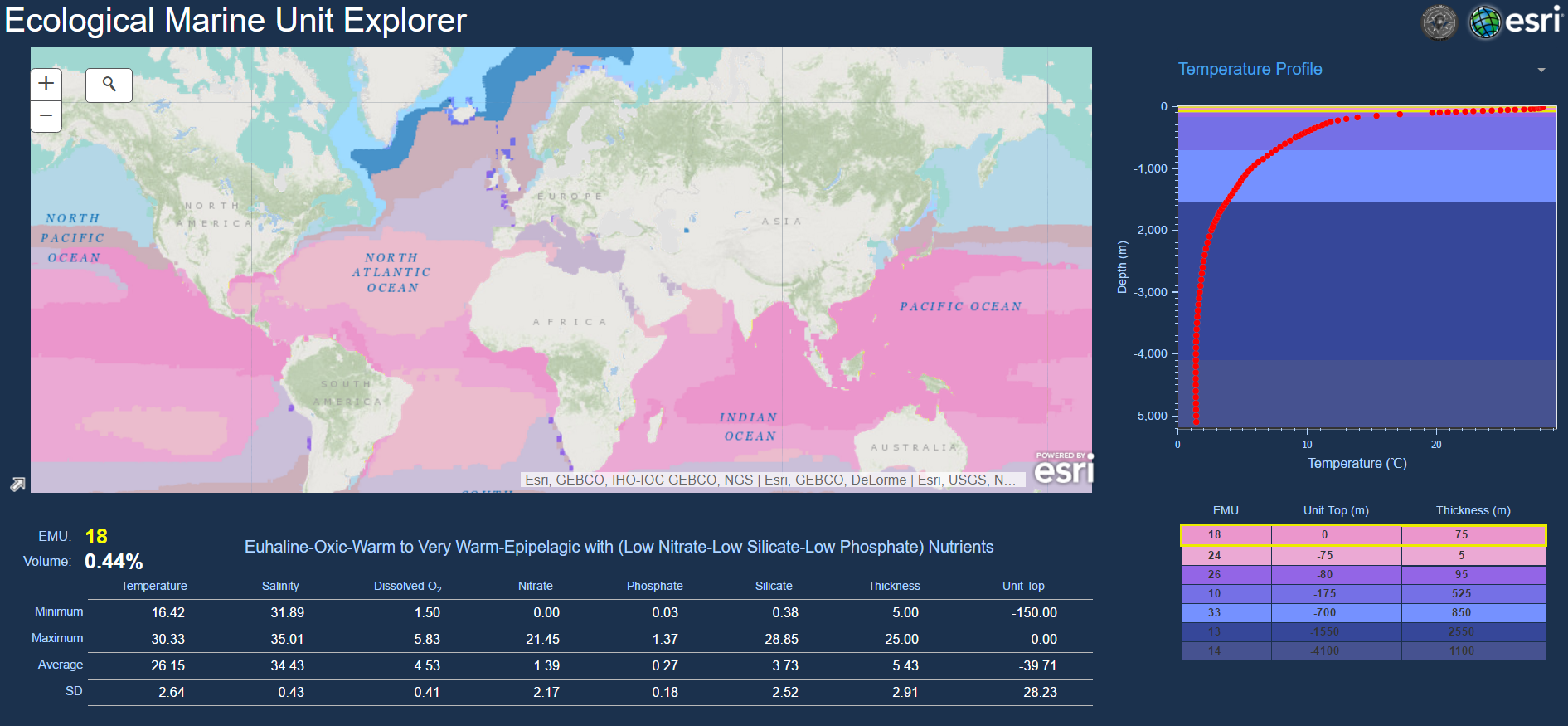
With this new 3D map, oceanographers, scientists, conservationists, and more can track ecosystems in unprecedented detail. This tool, which can divide the water masses of oceans into precise, detailed categories can help conservation efforts, as it maps data that shows why marine animals live where they do. This can help track which parts of the ocean will be most habitable for marine life - and thus more necessary to protect.
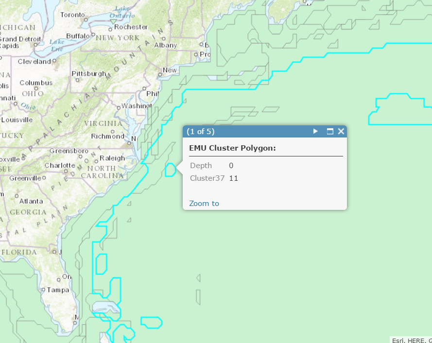
For a more detailed look at the different layers and data this new map can provide, click here!
