GIS In Action

National Fire Prevention Week

National Fire Prevention Week

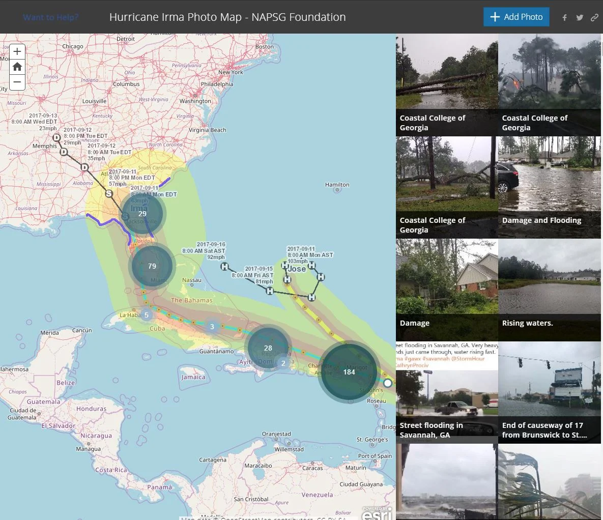
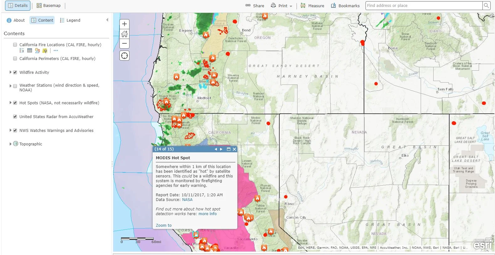
As this week is National Fire Prevention Week, we will take a look into how GIS technology is providing awareness and safety to the communities in Northern California that are currently being ravished by deadly wildfires. As mentioned in our previous post about Hurricane Harvey and Irma, GIS not only provides the general public with crucial information in disaster situations, but it also allows first responders and policy makers to work more efficiently. By clicking on the image below, you are able to view Esri's US Wildfire Activity Web Map.

World Teachers' Day - Incorporating GIS

World Teachers' Day - Incorporating GIS

Most people have had at least one teacher that has made a positive and lasting influence in their life. Today is recognized as World Teachers' Day. Thank you to all the hardworking teachers out there! Let's take a look at the unique and innovative manners in which teachers have incorporated GIS into their lesson plans. Esri documents inspiring ways teachers are Advancing STEM Education with GIS. 

Fall Foliage Prediction Maps

Fall Foliage Prediction Maps

September 22, 2017 is the astronomical start of fall here in the Northern Hemisphere! The interactive map below (click on image to link to website) has been produced to forecast peak leaf colors each year. The map compiles National Weather Service data on historical temperatures, forecast temperatures, and forecast precipitation, as well as historical leaf peak and peak observation trends in order to make the most accurate predictions.

GIS and Wildlife Management

GIS and Wildlife Management

On September 7, 1936 the last thylacine (Thylacinus cynocephalus aka Tasmanian tiger/wolf) died at the Hobart Zoo in Tasmania. Fifty years later the entire species was declared extinct. Today is remembered in Australia as "National Threatened Species Day." In more recent times, throughout the world, many humans understand and value the importance of biodiversity and protecting wildlife.How has GIS contributed to wildlife management and protection?

Total Solar Eclipse

Total Solar Eclipse

This upcoming Monday (August 21st, 2017), the sun and moon will align, giving Americans a front row seat to a rare celestial event - a total solar eclipse (of the heart...sorry)! You can click on the following image below to link to a variety of websites, maps (some interactive) which show the path of the 2017 eclipse, eclipse calculators, and other unique information pertaining to the subject matter.

Mapping Beer!

Mapping Beer!

Today is recognized as National Refreshment Day! Seeing as beer has been a rich part of Wisconsin culture and history, why not explore a creative approach that has been taken in the mapping of beer! First, here is an interesting read by Andrew Shears, Local to National and Back Again: Beer, Wisconsin, and Scale, a chapter in his book "The Geography of Beer."

Aviation and GIS Applications - National Air Traffic Control Day

Aviation and GIS Applications - National Air Traffic Control Day

July 6th, 1986 indicated the fiftieth anniversary of the formation of an airways traffic control system by the United States Bureau of Air Commerce. Within that fifty-year extent, the nation's air traffic control system had progressed from dependence on fairly simple, unsophisticated equipment and procedures to a much more advanced automated system, which safely and resourcefully processed millions of flights each year and functioned as an example for the world aviation community. With the expertise and dedication of thousands of Federal Aviation Administration employees (including air traffic controllers, electronic technicians, and engineers), the national air traffic control system presented a high level of security and efficiency, which has only continued to technologically thrive since!

GIS and Lightning

GIS and Lightning

Did you know that globally there are approximately 40-50 lightning flashes per second?! Maps that provide us with the distribution of lightning across the world are utilized for environmental, economic, and safety purposes. Lightning is a danger to humans, wildlife, and livestock. It also causes BILLIONS of dollars in damage to buildings, communication systems, power lines, and electrical equipment.

GIS & GISCorps

GIS & GISCorps

GISCorps is a group of GIS professionals that volunteer their time and skills in order to create a better world. Started in 2003, GISCorps' goals revolve around helping to improve quality of life through supporting humanitarian relief, enhancing environmental analysis, encouraging and fostering economic development, supporting community planning and development, strengthening local capacity by adopting and using information technology, and supporting health and education related activities.

GIS & Local Insights

GIS & Local Insights

Utilizing GIS for its mapping capabilities is a no-brainer. Answering questions like "what's the fastest route to work" or "where is that manhole located" are all great uses of GIS. But, using GIS for local insights can help individuals, businesses, communities, virtually anyone to make better, smarter choices.

GIS & Ocean Ecosystems

GIS & Ocean Ecosystems

With this new 3D map, oceanographers, scientists, conservationists, and more can track ecosystems in unprecedented detail. This tool, which can divide the water masses of oceans into precise, detailed categories can help conservation efforts, as it maps data that shows why marine animals live where they do. This can help track which parts of the ocean will be most habitable for marine life - and thus more necessary to protect.

GIS & WI MS4 Audits

20170118_100651
20170118_100651

Yesterday, our Waukesha office held a seminar concerning Wisconsin DNR audits for MS4 permit holders. While a bunch of great information was discussed, our very own Bronson Jastrow, GIS whiz and famed #TipTuesday writer, presented on how GIS can help keep communities prepared- especially if they're facing a dreaded audit!

One of the best ways GIS can help is by keeping communities organized. Our GIS capabilities allow you to link documents (such as design and compliance records) straight into a map, making them easy to access and all compiled in the same place.

2
2

Beyond the simplicity of linking, viewing, and organizing documents, we have a suite of tools that can make preparing for a DNR audit a breeze, such as: Erosion Control & Inspection, Illicit Discharge, Pond Inspection, and Storm Structure Maintenance & Cleaning - keeping a history of compliance on each storm water asset.

2
2

If you want more information on WDNR MS4 audits and how GIS can help, check in with your favorite GIS tech, or hop over to our website where we have the presentation slides uploaded!