
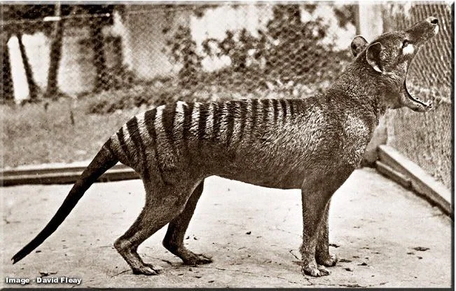

On September 7, 1936 the last thylacine (Thylacinus cynocephalus aka Tasmanian tiger/wolf) died at the Hobart Zoo in Tasmania. Fifty years later the entire species was declared extinct. Today is remembered in Australia as "National Threatened Species Day." In more recent times, throughout the world, many humans understand and value the importance of biodiversity and protecting wildlife.
How has GIS contributed to wildlife management and protection?
The Esri Conservation Program provides organizations and individuals with access to Esri expertise and technology in support of their particular conservation goals.
Follow the highlighted link to read more about the specific work this Spatial Conservation Planning Officer is utilizing GIS to manage, analyze, and map wildlife data (distribution, habitat use/preferences, changes in habitat).
