

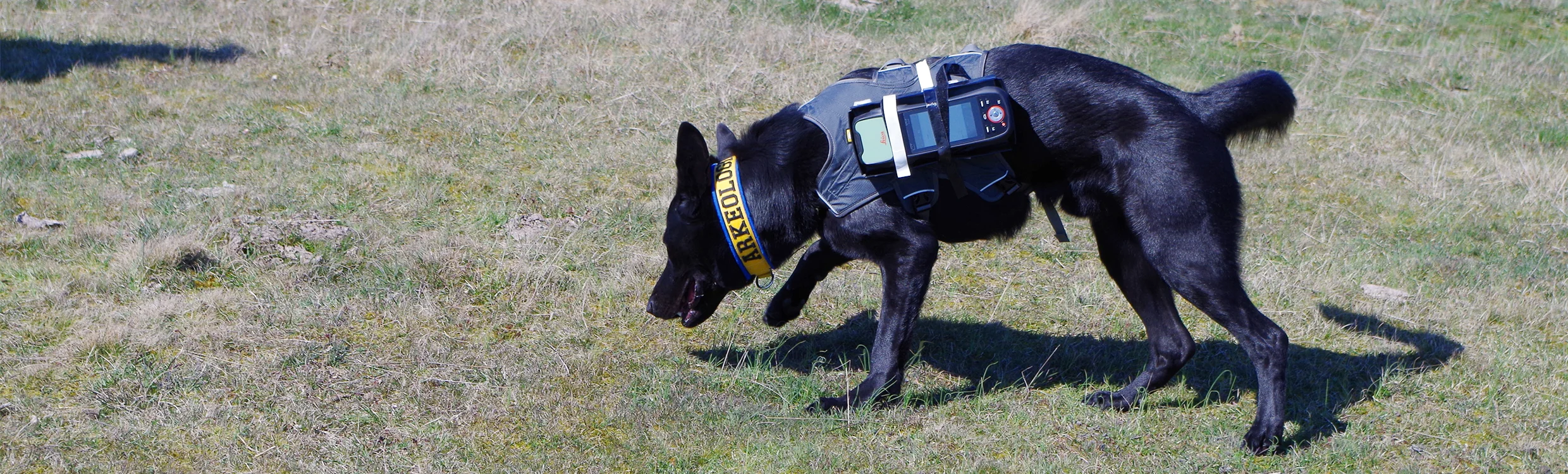
As we do so much for our little (or big) buddies, they have done some pretty amazing things for us humans too. To avoid getting off the topic of GIS, why don't I introduce you to Fabel? Fabel is the world's first licensed Arkeologihunden (archaeology dog) that is digging to make a difference with the assistance of GIS technology!

Fabel has been trained to locate ancient human remains at archaeological excavations. Using Fabel to find remains helps researchers to plan their time at the excavation optimally and is also a cost-effective solution.
When Fabel began working on an extremely large and complex dig at Sanby Borg (located on the Swedish island of Öland), it became clear to researchers that a digital solution had to be found to transform and speed up workflows.
To read about how Fabel used the Zeno 20, a new survey-grade GIS collector to assist scientists go to: Archaeologists Use a Drone and a Dog to Map a Dig.
