Women's History Month - Women in Mapmaking and Geospatial Technology

Women's History Month - Women in Mapmaking and Geospatial Technology

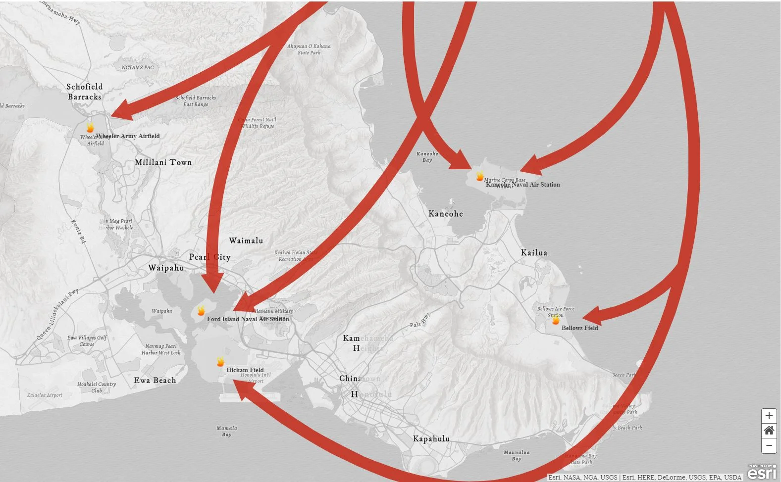
The month of March is deemed National Women's History month! We are going to mention a couple (of the many) ways in which women have contributed to the world of mapping. "As the United States entered WWII, trailblazing women like Bea McPherson, BS ’43, took on the task of providing essential handmade maps for the war effort—and charted the course for today’s women mapmakers."

Snapping Feature

Snapping Feature

Oh snap! Have you utilized the snapping feature in your GIS before? If not, we are here to give you a quick rundown on it's function/purpose! The textbook GIS definition of "snapping" is: The process of moving a feature to match or coincide exactly with another point or feature's coordinates when your pointer is within a specified distance. It is commonly used to increase accuracy when using a variety of tools including editing, georeferencing, and measuring tools.

National Boy Scout Day - Incorporating GIS into Activities

National Boy Scout Day - Incorporating GIS into Activities

Today is recognized as National Boy Scout Day, with the official birthday being February 8th, 1910. That is a long time! Using a paper map and compass are valuable and essential skills taught to Boy Scouts. However, we thought it would be interesting to explore some ways in which GIS has been incorporated into scouting activities. Fun fact: The Boy Scouts (and Girl Scouts!) offer badges that tie into GIS, such as geocaching and surveying.

California - Fires and Flooding

California - Fires and Flooding

At least 13 lives have been lost in a tragic mudflow that swept across Ventura and Santa Barbara Counties in California earlier this week. Heavy rains have made Southern California susceptible to flooding and debris flows, particularly following the recent wildfires which stripped the steep terrain of vegetation. Vegetation is a crucial component involved in holding the land together during periods of precipitation. The fires transformed the physical properties of the soil, making it less absorbent. Thus, the soil becomes much more vulnerable to erosion.

Mapping the Winter Solstice

Mapping the Winter Solstice

Well, it is officially winter! The time and date of the solstice change ever so slightly by year, but this year’s solstice occurs at 11:28 a.m. Eastern Time. The winter solstice marks the shortest period of daylight in the Northern Hemisphere. However, today is not the day of the latest sunrise or earliest sunset. Rather, most areas within mid-latitudes witness the earliest sunset two weeks prior to the solstice, while the latest sunrise does not occur until the beginning of January!

Mapping Pearl Harbor

Mapping Pearl Harbor

December 7th is recognized as National Pearl Harbor Remembrance Day in the United States, which took place 76 years ago on this date. If you click on the image below you will be linked to an in depth and engaging story map (via Esri). The story map utilizes pictures, videos, and maps in order to retell the complex events that took place at Pearl Harbor.

Using GIS Technology in Animal Shelters

Using GIS Technology in Animal Shelters

October is recognized as national "adopt a shelter dog" month. Not surprisingly, GIS technology is being employed to help lower the population of pups in shelters. GIS can be utilized for mapping locations of animals. It lets users observe various data sets in a manner which provides greater insight into their community's animals and their needs; that allows for a more productive use of resources.

National Fire Prevention Week

National Fire Prevention Week

As this week is National Fire Prevention Week, we will take a look into how GIS technology is providing awareness and safety to the communities in Northern California that are currently being ravished by deadly wildfires. As mentioned in our previous post about Hurricane Harvey and Irma, GIS not only provides the general public with crucial information in disaster situations, but it also allows first responders and policy makers to work more efficiently. By clicking on the image below, you are able to view Esri's US Wildfire Activity Web Map.

Cemetery Tool

Cemetery Tool

The Cemetery Records tool is a specialty tool we offer as part of our GIS services. This tool is tailored to fit your data. Despite the rather grim topic, a Cemetery Records map can be quite efficient when made available to the public. For example, if a community member calls your municipality in search of a genealogy report, you can guide them to the cemetery map; this way, they are able to pull up the information they desire on their own.

World Teachers' Day - Incorporating GIS

World Teachers' Day - Incorporating GIS

Most people have had at least one teacher that has made a positive and lasting influence in their life. Today is recognized as World Teachers' Day. Thank you to all the hardworking teachers out there! Let's take a look at the unique and innovative manners in which teachers have incorporated GIS into their lesson plans. Esri documents inspiring ways teachers are Advancing STEM Education with GIS. 

Add, Subtract, and Save Results

Add, Subtract, and Save Results

Today we will be discussing the "Add/Subtract" results tool. In this example, we will be generating a mailing list to notify property owners of upcoming road construction that will be happening in their area. First, we will use the identify tool to select our general area(s) of interest. In this instance, it is best to use "identify by line" because we would like to select multiple parcels in a row along the same street.