
The Cemetery Records tool is a specialty tool we offer as part of our GIS services. This tool is tailored to fit your data. Despite the rather grim topic, a Cemetery Records map can be quite efficient when made available to the public. For example, if a community member calls your municipality in search of a genealogy report, you can guide them to the cemetery map; this way, they are able to pull up the information they desire on their own.
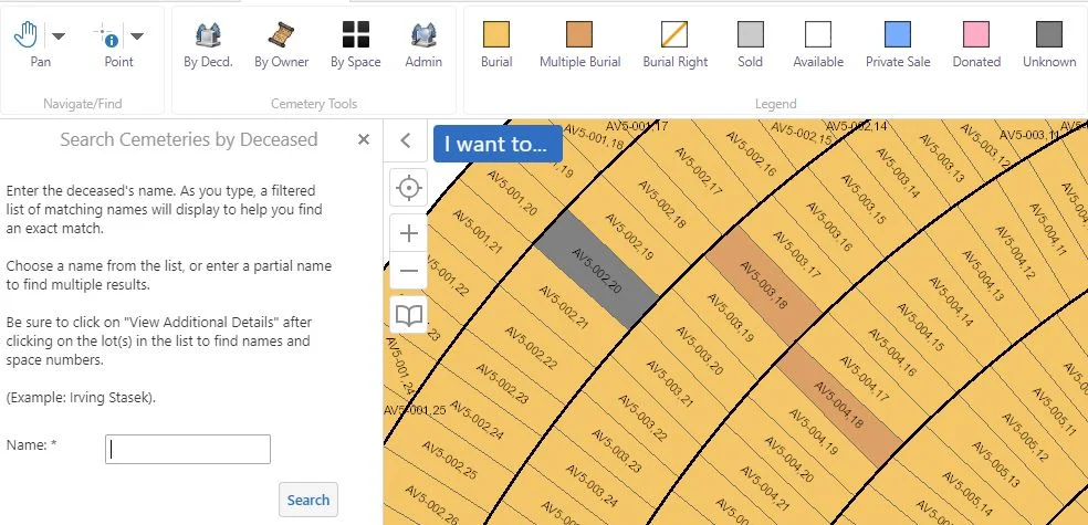
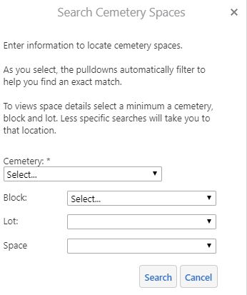
Below is an example of some of the customization options others have requested for their Cemetery Records tool.

The public is able to access information by conducting a search. In this case, searches may be performed by the name of the deceased, cemetery owner, space (i.e. cemetery name, block, lot, space, etc).
Particular information can still be entered into your GIS that is not made accessible to the public.
If you think this tool may benefit you and the members of your community, our GIS staff here at Ruekert & Mielke are standing by to answer all your questions.
