GIS In Action

End of Construction Season Planning GIS Cheat Sheet

End of Construction Season Planning GIS Cheat Sheet

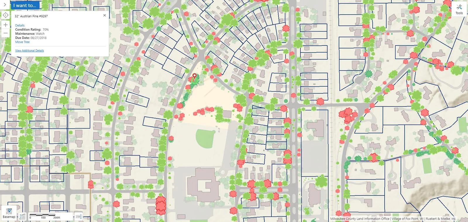
Why does it always feel like the end of construction season arrives when there’s still too much to do and not enough time to get everything done? While we can’t days to your calendar, our GIS Maintenance Cheat Sheet can help you stay organized and avoid administrative headaches as you navigate this busy time of year.

Keeping Up with Forestry: The Tree Management Tool

Keeping Up with Forestry: The Tree Management Tool

The management and maintenance of trees is essential in strengthening the quality of living in urban spaces. Optimal tree density and distribution is a vital aspect of many urban planning projects, as trees have an assortment of benefits on people and the environment. Learn how AssetAlly can assist you with managing your community's trees.

GIS Cheat Sheet for End of Construction Season Planning

GIS Cheat Sheet for End of Construction Season Planning

Have you ever noticed that there just never seems to be enough time to get done what needs to be done when it comes to the end of construction season?

AssetAlly has the capability of helping you maintain and organize all of your documents in a safe and convenient location.

How GIS is Making Donating Easier

How GIS is Making Donating Easier

Today is World Blood Donor Day 2018. There are various ways in which GIS has contributed to saving lives through blood donation applications. Aside from blood donor applications, there are plenty of GIS based applications that focus on other forms of donation. Now, let's take a look at how GIS is assisting us in making the world a better place!

Why GIS is Important to Infrastructure Management

Why GIS is Important to Infrastructure Management

This week is National Infrastructure Week. GIS is a valuable contribution in terms of planning, managing, and maintenance of utility infrastructure. Identifying facilities, tracking work, planning operations and even doing marketing in utilities depends on having all of the data accessible and open for collaboration. Read on to learn more about the importance of GIS in infrastructure management. Success story included!

Women's History Month - Women in Mapmaking and Geospatial Technology

Women's History Month - Women in Mapmaking and Geospatial Technology

The month of March is deemed National Women's History month! We are going to mention a couple (of the many) ways in which women have contributed to the world of mapping. "As the United States entered WWII, trailblazing women like Bea McPherson, BS ’43, took on the task of providing essential handmade maps for the war effort—and charted the course for today’s women mapmakers."

National Boy Scout Day - Incorporating GIS into Activities

National Boy Scout Day - Incorporating GIS into Activities

Today is recognized as National Boy Scout Day, with the official birthday being February 8th, 1910. That is a long time! Using a paper map and compass are valuable and essential skills taught to Boy Scouts. However, we thought it would be interesting to explore some ways in which GIS has been incorporated into scouting activities. Fun fact: The Boy Scouts (and Girl Scouts!) offer badges that tie into GIS, such as geocaching and surveying.

California - Fires and Flooding

California - Fires and Flooding

At least 13 lives have been lost in a tragic mudflow that swept across Ventura and Santa Barbara Counties in California earlier this week. Heavy rains have made Southern California susceptible to flooding and debris flows, particularly following the recent wildfires which stripped the steep terrain of vegetation. Vegetation is a crucial component involved in holding the land together during periods of precipitation. The fires transformed the physical properties of the soil, making it less absorbent. Thus, the soil becomes much more vulnerable to erosion.

Mapping the Winter Solstice

Mapping the Winter Solstice

Well, it is officially winter! The time and date of the solstice change ever so slightly by year, but this year’s solstice occurs at 11:28 a.m. Eastern Time. The winter solstice marks the shortest period of daylight in the Northern Hemisphere. However, today is not the day of the latest sunrise or earliest sunset. Rather, most areas within mid-latitudes witness the earliest sunset two weeks prior to the solstice, while the latest sunrise does not occur until the beginning of January!

Mapping Pearl Harbor

Mapping Pearl Harbor

December 7th is recognized as National Pearl Harbor Remembrance Day in the United States, which took place 76 years ago on this date. If you click on the image below you will be linked to an in depth and engaging story map (via Esri). The story map utilizes pictures, videos, and maps in order to retell the complex events that took place at Pearl Harbor.

Using GIS Technology in Animal Shelters

Using GIS Technology in Animal Shelters

October is recognized as national "adopt a shelter dog" month. Not surprisingly, GIS technology is being employed to help lower the population of pups in shelters. GIS can be utilized for mapping locations of animals. It lets users observe various data sets in a manner which provides greater insight into their community's animals and their needs; that allows for a more productive use of resources.