
Did you know that Wisconsin's rivers have a variety of islands that are accessible by boat for camping?
June is just around the (river) bend! It is recognized as National Camping Month AND National Great Outdoors Month.
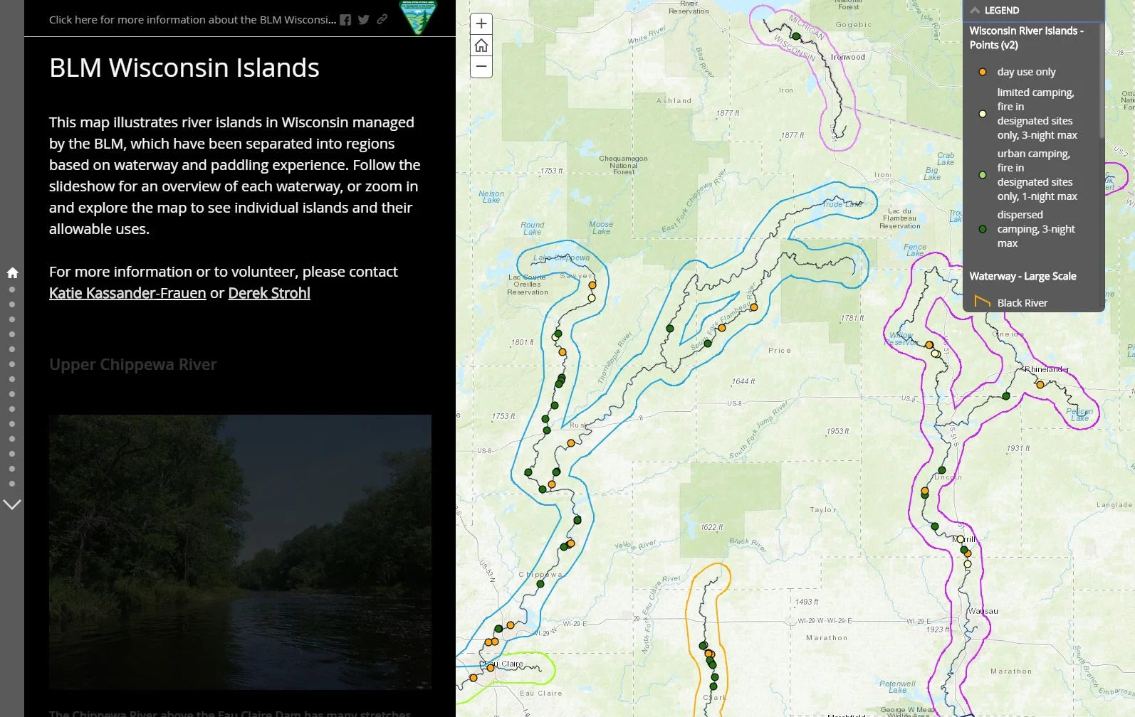
What better way to celebrate than taking a paddling/camping trip down one of Wisconsin's scenic river waterways?
The Bureau of Land Management (BLM) has put together an Esri Story Map, which contains an interactive map illustrating Wisconsin's river islands (separated into regions based on waterway and paddling experience). If you zoom in on the map, you are able to view information about the individual islands (County, Acreage, Waterway, Allowable uses, etc). Also included in the Story Map is a slideshow preview of each of the Wisconsin waterways.
This super fun Story Map could be the starting point for planning your super fun camping trip on one of Wisconsin's river islands!
