
One of the more recent features that have been added to your GIS applications allows you the ability to add an image for a new point (or points) on the map, using the markup tool. What does this mean? Well, we'll show you! First, you will want to go under "Markup" in your viewer and choose the point option.

Next, you will click on "Styles" in the toolbar.

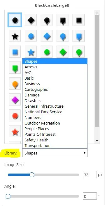
You will have the option to pick from a style type in the drop down menu. In this case, we will select, "Choose an image."

As you can see in the screen shot below, after you select "Choose an image", there are a variety of categories in the image library that you may use. Additionally, you may also adjust the image size and the angle which it is at.

In this example, we will select "Numbers" from the image library. You simply pick the image that you would prefer to use as a point on the map. Click on your preferred location within the viewer, and there you have it!

This can be very useful if you would like to save or share a project in order to relay information or general areas of interest/concern. Using a basic point feature may not always be the most effective manner in which you mark up your application. Choosing an image allows for better visualization and understanding when you would like to be more specific in your markups. Check out all the image libraries and see if there's any you like.

We hope this will be helpful to you in the future!
