AssetAlly and Esri: What Our Partnership Means to You

AssetAlly and Esri: What Our Partnership Means to You

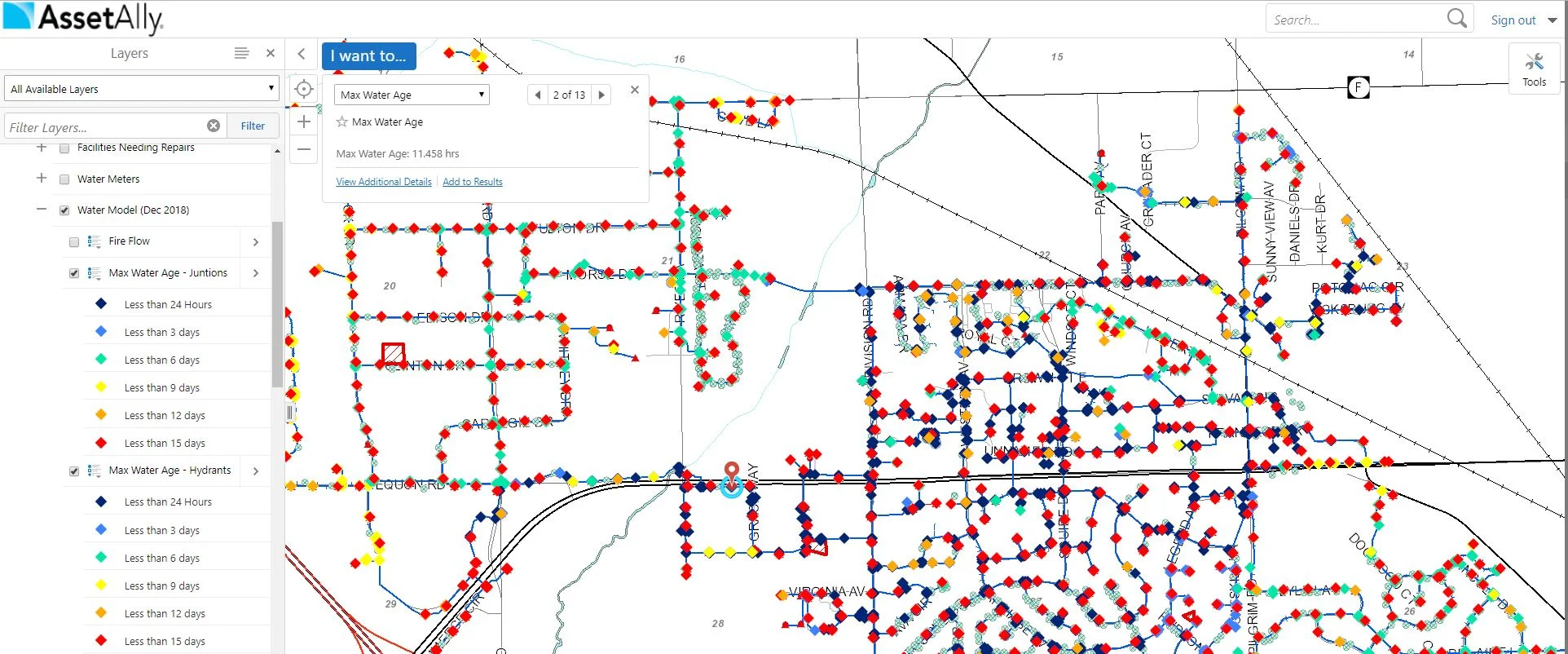
When it comes to selecting a GIS provider, municipalities must often choose between a tailor made solution that’s easy to navigate but offers limited capabilities, and a generic solution that may have endless, robust capabilities but is impossible for a non-GIS expert to maneuver. Learn why our partnership with ESRI gives your community the best of both worlds.

The Map Gallery and Your Frustration-Free Future

The Map Gallery and Your Frustration-Free Future

Learn how the Map Gallery function in AssetAlly can help you and your team avoid unnecessary interruptions.and increase efficiency by giving you access to your address, utility, zoning, road maps, and more in one convenient, filing cabinet-free, digital location.

Are You Getting the Most out of Your GIS?

Are You Getting the Most out of Your GIS?

Whether you’re a new client, a new municipal employee, or long-time power user, it’s important to know what makes AssetAlly so different from other GIS providers in order to effectively maximize its benefits across all users and departments. There are so many reasons why AssetAlly stands out as the best GIS solution for municipalities, but for the sake of time, we’ll highlight our three favorite examples here.

How to Export and Maximize Your GIS Data

How to Export and Maximize Your GIS Data

With just a few clicks in your map viewer, you can export data for use in reports, presentations, and other familiar software like Excel, PowerPoint, and ArcGIS. This data allows you to take the power of AssetAlly into your organization. Learn how to make the most of your AssetAlly data in this easy to follow tutorial.

How AssetAlly Can Help Your Community Prep for Spring

How AssetAlly Can Help Your Community Prep for Spring

Spring has sprung! Well, maybe not quite yet... but it’s getting closer! Winter can be a chaotic time of year for municipalities dealing with snow removal, frozen pipes, property damage from snowplows, and more. Learn how AssetAlly can help your municipality prepare for spring and get the most out of your GIS by completing sign inventories and performing inspections when cleaning infrastructure.

New Year, New Newsletter, New Events!

New Year, New Newsletter, New Events!

Welcome to our new and improved AssetAlly newsletter! Formerly distributed through our website directly, we hope you’ll look forward to receiving helpful monthly user tips, updates on new features, frequently asked questions, and other valuable info related to your GIS directly to your inbox each month. To start, here’s a few of the events we’re most looking forward to in 2020!

How to Jump Start Your GIS Implementation

How to Jump Start Your GIS Implementation

The benefits of using a GIS to manage your community’s assets are vast, but the implementation process can often seem overwhelming, especially when there are multiple stakeholders and departments involved. Fortunately, there are steps you can take at the beginning of the set-up process to avoid unnecessary headaches and set your team up for long-term success. Here are a few of our best tips to help your municipality jump start its GIS implementation.

Streamline your Processes: The Manhole Inspection Tool

Streamline your Processes: The Manhole Inspection Tool

Manholes are the primary points of access to your community’s underground infrastructure. The AssetAlly Manhole Inspection Tool streamlines the inspection process, giving your team portable, digital access to previous inspection data and the ability to efficiently complete new inspections on-the-go.

Visualize Your Road Ratings Data in GIS

Visualize Your Road Ratings Data in GIS

Every odd year, Wisconsin municipalities are required to conduct road ratings and submit their findings to the Wisconsin Department of Transportation (WisDOT). Learn how AssetAlly can help your team visualize your ratings and the evolving state of your community’s roads, making it easier to prioritize road maintenance and adjust your budget accordingly.