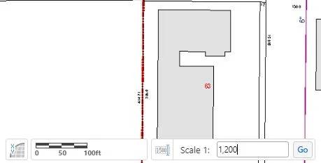
Have you ever tried to make an exhibit to print in your GIS? Have you dealt with adding text/markups that don't print quite the size you thought they would? If so, it's likely because of your map's scale. Read on to find out more!

Articles
Explore AssetAlly Tips & Tools.
See GIS in Action.
If you are a frequent user of GIS, you've probably encountered a few situations where you need to see a large number of layers, but only need to access the data for one or two of them. If you've ever wondered how to narrow down what results you'll bring back when using identify tools, then you're in the right place!
This week we will cover the basics of our Illicit Discharge Inspection Tool! We decided to make the long and grueling inspection process easier for you by putting this tool in your AssetAlly application. Not only does the Discharge Inspection Tool allow you to access important attribute data associated with outfall structures in your community, but it also conveniently produces an organized PDF report containing the information you entered into your GIS.
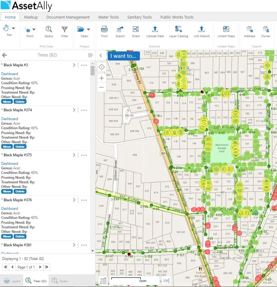
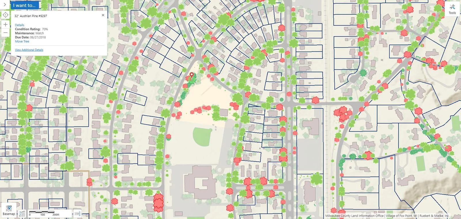
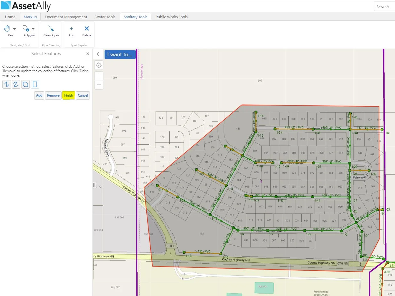
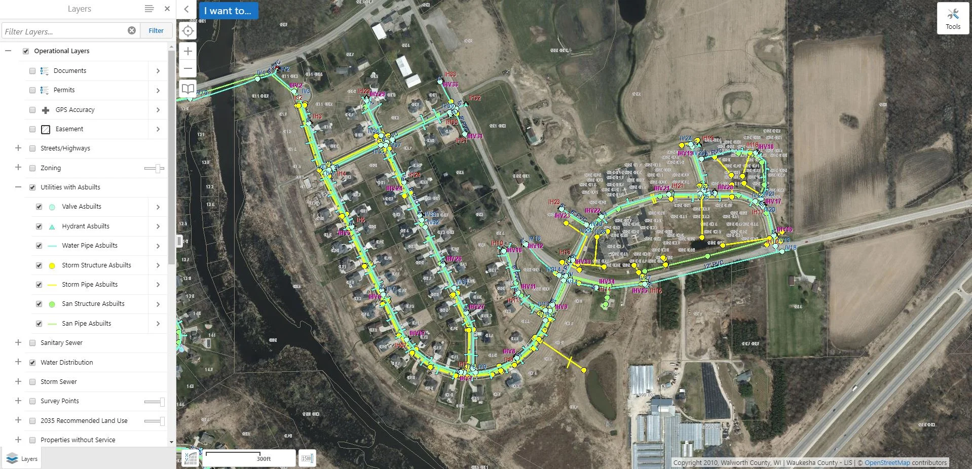
Populating attribute fields in your GIS may seem like a daunting or even unnecessary task at times, but the information being added to your utilities will more than likely come in handy down the line. Aside from being able to access important utility information quickly (pipe size, length, material, inverts, year installed, etc.), it can make searching for particular data in your GIS (such as documents) much easier.
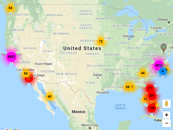
Today is World Blood Donor Day 2018. There are various ways in which GIS has contributed to saving lives through blood donation applications. Aside from blood donor applications, there are plenty of GIS based applications that focus on other forms of donation. Now, let's take a look at how GIS is assisting us in making the world a better place!
This week is National Infrastructure Week. GIS is a valuable contribution in terms of planning, managing, and maintenance of utility infrastructure. Identifying facilities, tracking work, planning operations and even doing marketing in utilities depends on having all of the data accessible and open for collaboration. Read on to learn more about the importance of GIS in infrastructure management. Success story included!
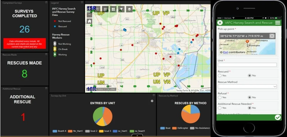
May 4th is recognized as International Firefighters' Day! So, how hot is GIS when it comes to fighting fires? Firehouse Magazine published an article on how the NAPSG Foundation assists first responders throughout challenging events and disasters by contributing GIS-based field information and situational awareness tools.
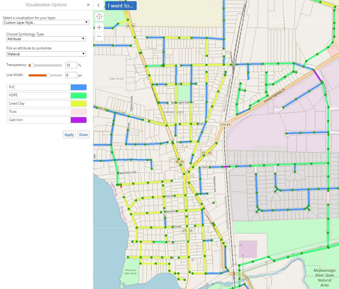
Today we will be showing you another fun way in which we are able to use the "Turn on/off layer visualizations" for symbolizing various attributes on your utilities. In our example today, we will be visualizing the sanitary pipes in our GIS based off of their material makeup. The first step is turning your sanitary pipe layer on. We will then click on the arrow next to the item in the layer list.